Case Study: GAIL India Ltd.
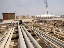
GAIL (India) Ltd. is operating & maintaining approximately 10,000Kms of natural gas/RLNG/LPG pipeline and HVJ Pipeline is the largest pipeline network of India and which consists of more than 5000 Kms of pipelines. These pipelines are passing through forest, rocky, marshy and desert terrain and having many major / minor road, rail, river, canal crossings. These pipeline also passing through various states like Gujarat, M.P., U.P., Haryana, Rajasthan, and NCR regions etc. The day to day maintenance activities of pipeline is being looked by different maintenance base and consists of approximately 15 maintenance base. Pipeline is being also monitored through line walk (Foot patrolling) done by GAIL's personnel/security personnel and frequency of line walk is on monthly/quarterly basis.

GTI developed a GPS based online tracking system of foot patrolling of HVJ pipeline network. To cater the requirement of on line tracking of foot patrolling a number of handheld devices are deployed. For the monitoring of movement of foot patrolling personnel, master server is located at one location centrally either at GAIL Noida and tracking of each foot patrolling personnel is monitored by different maintenance base by multiple users.
OBJECTIVE
The main objective of this project is to ensure the effectiveness of foot patrolling of the pipeline by doing the monitoring of foot patrolling personnel on real time basis while doing the foot patrolling of pipeline. The same may be defined as follows; Ability to track security personnel from starting point to destination point in real time basis.Visually represent the geographical locations of the security personnel while doing the foot patrolling. Ability to provide accurately network-wide location information of the entire Groups of Security Personnel. Unauthorized halt, deviation from predefined route to be highlighted through exception reports. System has to be viewed by users at different locations and also with different set of Security Personnel (Grouping of Security Personnel by user).

GTI'S SCOPE OF WORK INCLUDED:
ROUTE MAPPING
We deploy sufficient number of team for doing GPS route mapping of the entire pipeline. Necessary tools-tackles like GPS receiver and vehicle for the route mapping was arranged by us. The GPS receiver used for route mapping shall be of reputed make and will have the accuracy of +/- 1.5 meter and shall have the continuous recording facility. The team walked along the pipeline and collect information about the route & map it by GPS co-ordinates.
GPS coordinate was taken for the following features;
- TLP Points
- K.M. markers
- River crossings (start & end points).
- Major road crossings
- Minor Roads including kachha road crossings
- Canal crossings ( start& end points)
- Railway line crossings
- Important land marks with in immediate vicinity of the Pipeline ROU.
- Any other features described by GAIL during the GPS surveys.
GPS co-ordinate was taken on at least on every one Kms, however if turning point fall prior to one Kms then GPS co-ordinate shall be taken on the turning point also. GPS co-ordinate of all turning points was also taken during the route survey.
After collection the data GTI Mapped the entire pipeline and entire mapped route was approved by GAIL's site in charge/engineer -in-charge. A geo fencing bandwidth was also be defined during the mapping of the pipeline in the software to track the movement of line walk personnel.
Scope of Supply:
- Garmin GPS loggers
- Personal IP65 compliant GPS trackers
- GPS Tracking Application as required by GAIL
- Application Server
GPS TRACKING APPLICATION SOFTWARE
The software is web based application and accessible through the Intranet from all Station and SV locations using the logon facility through multiple levels of security. Access to the Each Station is given for concerned areas only. There is no limitations to the number of clients accessing sever from internet.
The basic features of the software is:- Real Time Tracking - Should provide real time information on ROU monitoring personnel & ROU night patrolling vehicle status based on location, speed and time.
- Online Alerts - Should provide critical alerts such as Walking Speed,stoppages, Any Detour Taken. Alert Message shall be given to the pipeline officer/security officer either on their mobile or in PC.
- Trip Replay - Should provide replay of the routes travelled by ROU monitoring personnel plotted on the map.
- Route of 20 mtrs each side from the pipeline. Centre Line is to be put into the MAP.
- Deviation reports to be generated.
- Daily Initialization & closing of each unit by base station
- Option to Put Remarks at the end of the trip, which shall be reflected in Daily report.
- Reports - Should provide reports by date, ROU monitoring Personnel ID or By Name. Generate standard reports on criteria such as ROU monitoring personnel stoppages, ROU monitoring personnel speeding or trip summary.
- ROU monitoring Personnel and Group Management – Update ROU monitoring Personnel profiles, as well as manage their groups and types.
- Sending of report to respective I\C, Officer through email.
- The software shall have the capability of addition of other pipelines of GAIL and same shall be mapped in the software in the future during expansion of pipeline tracking for other pipelines.
The following are the detailed requirement from the software for the reports and tracking:
- The software has the customized and MAP for the Personnel Tracking System (PTS).
- The real time location of the security Personnel is available on the MAP
- The route undertaken by the security Personnel's is shown on the MAP.
- All the specified points (way points) mentioned by GAIL is shown on the MAP.
- Total Distance travelled, distance travelled between stops. Total time, time taken between stops, time taken during a trip.
- Server is capable to maintain historic data for at least 06 months.
- Over Speed alerts on the web application.
- Predetermined (Dynamic) customized trip reports and exception reports.
- MAP through a web link provided to them. View and track Security Personnel by place of origin wise or destination wise.
- Location accuracy of + or - 5 meters.
